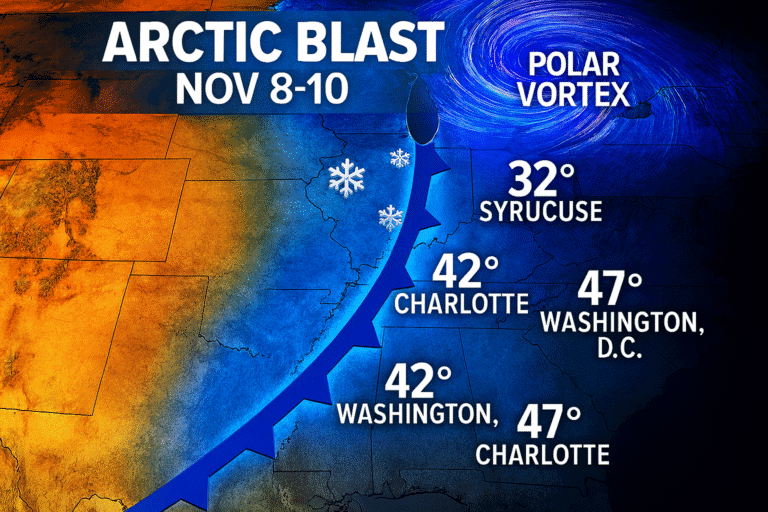
December’s blast of Arctic air has arrived across much of the country. Temperatures dropped 10-15 degrees below normal starting Dec. 3 when the polar air moved across the Great Lakes. The National Weather Service and AccuWeather say this won’t be the last Arctic front—more cold is coming and forecasters expect it to stick around through mid-December.
Arctic blasts are hitting the north and eastern regions with potentially record-breaking lows. Holiday festivals and parades planned for the weekend are facing frosty temperatures that could break records in some areas.
The Arctic front that moved across the Great Lakes on Dec. 3 triggered advisories for snow squalls in New England by Thursday, Dec. 4. Meteorologists say the polar air will linger. Most locations outside the Southwest will see colder than typical conditions for early December. The prediction center warns additional winter weather advisories may be needed later in the week.
Out West it’s a different story. Temperatures there will trend warmer into next week. Those warmer-than-average temperatures are forecast to spread into the central and southern Plains, according to the Weather Prediction Center. The country is split—freezing in the east, mild in the west.
Between December 6-7, daytime highs and morning lows could sink 10-15 degrees below normal in the Northern Plains and Upper Midwest. The prediction center said that cold air mass is moving eastward.
Pittsburgh is a good example. Temperatures will likely stay below 40 degrees through at least Dec. 9. The local weather service office noted on Dec. 3 that the last time Pittsburgh didn’t see temperatures rise above 40 during the first nine days of December was 2005. Almost 20 years ago.
Some locations in the northern Plains could see temperatures below zero on Dec. 4 as the polar air swoops in, AccuWeather said. The polar vortex affects weather patterns. It occasionally sends massive cold air masses down from the Arctic, and when that happens temperatures drop fast.
Cold waves over Dec. 5 and 6 (and beyond) are forecast to drop temperatures well below the normal average. Paul Pastelok, a long-range meteorologist for AccuWeather, has been tracking these systems.
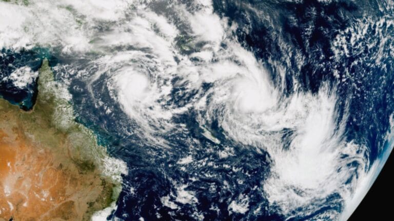
A snowstorm moved through the Rockies overnight Dec. 3-4. It brought Denver its largest snowfall of the season so far. In the Northern Rockies, probabilities are climbing for big snowfall at higher elevations. Forecasters say 1 to 2 feet of snow is possible there.
“The blast of Arctic air will bring snow showers and snow squalls to parts of the Great Lakes and Northeast,” said Alex Duffus, AccuWeather meteorologist.
The first December storm that moved into the East collided with an offshore low. It brought plentiful moisture into the Northeast—as much as 12 inches of snow in some areas.
New York saw the highest totals. Phoenicia (10 miles west-northwest) recorded 12 inches. Clifton Park, Callicoon Center, Liberty, and Mongaup Valley all got 10 inches or more. New Hampshire’s Laconia measured 10 inches. Maine’s North New Portland tallied 9.5 inches. In Massachusetts, Ashburnham got 8.9 inches. Vermont’s Arlington collected 8.7 inches. Over in Pennsylvania, Damascus and Narrowsburg each received 8.0 inches. Ohio locations Hollansburg and Lakeview saw 6.6 inches. New Jersey’s Kittatinny Lake recorded 3.6 inches.
Significant totals for early December. Some of these areas don’t usually see this much snow until mid-winter.
A winter storm will move across an area extending from Texas to Delaware late in the week. Heavy rain and potentially freezing rain are expected along a line from Texas into Georgia on Dec. 5. Then it moves further north on Dec. 6.
“A fast-moving storm can spread a swath of snow from the Tennessee Valley to the mid-Atlantic late Thursday night (Dec. 4) through Friday night (Dec. 5),” said Dan DePodwin, AccuWeather’s vice president of forecasting operations.
“While this does not appear to be a major winter storm, it’s certainly enough to cause slippery roads on Friday and Friday night,” DePodwin said. Snow will fall in the mountains of Kentucky, Tennessee, North Carolina, and Virginia. The snow can also spread north toward Washington, DC, potentially causing slick roads Friday.
There’s a marginal risk of severe weather in the Florida Panhandle and southern Georgia along the boundary of the system. The system could stall and present a flash flood threat, the prediction center said. Stalled systems can drop heavy rain fast.
Travel Conditions Deteriorate Across Multiple Regions
Road conditions are getting worse. The weather service is telling people to pay attention to changing forecasts, especially if they have travel plans this week or weekend.
Frosty temperatures started right at the beginning of December. Not great timing for people with holiday events planned. Snow showers and squalls are hitting parts of the Great Lakes and moving into the Northeast. Some areas are seeing their biggest snowfall of the season.
Freezing rain makes roads slick fast, even when accumulations aren’t huge. Areas from Texas up through Georgia and into the mid-Atlantic need to watch for that on Dec. 5 and 6. Morning and evening commutes could be rough.
Overnight Dec. 3-4 brought the largest snowfall to Denver so far this season. Higher elevations in the Northern Rockies might see 1 to 2 feet. Big snow even for mountain areas used to winter weather.
Cold waves are expected beyond just Dec. 5 and 6. This pattern could drop temperatures well below normal average for a while. Not just a quick cold snap that passes through in a day or two.
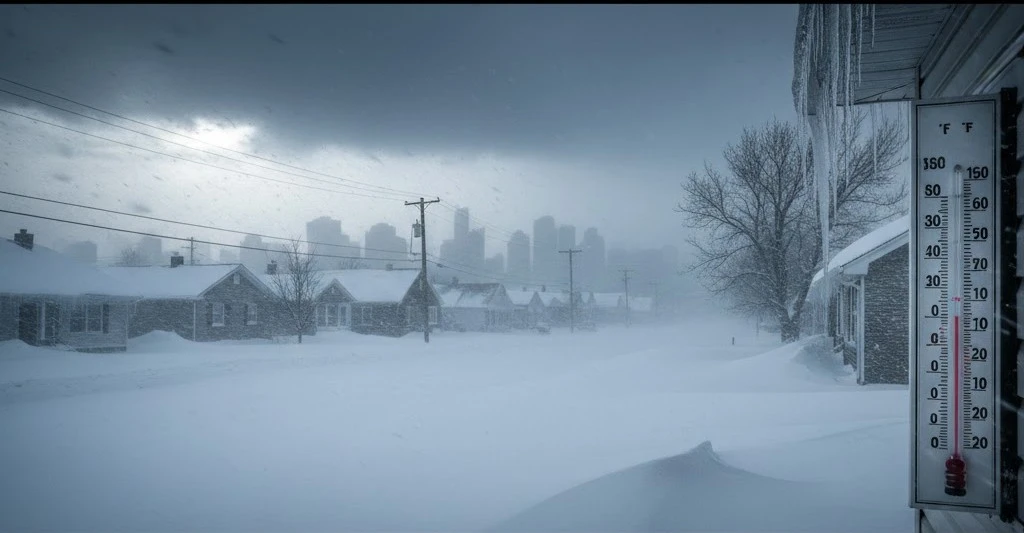
Pittsburgh is one example but other cities in the Upper Midwest and Northern Plains are seeing similar patterns. When daytime highs stay 10-15 degrees below normal for several days running, it affects everything. Heating costs go up, cars take longer to warm up, pipes can freeze if homes aren’t properly winterized.
The Weather Prediction Center keeps updating its forecasts as new data comes in. Winter weather advisories pop up when conditions warrant them. People in affected areas should check local weather service offices for current information specific to their location.
Some locations could see below zero temperatures as the polar air keeps swooping in. Cold enough to cause frostbite on exposed skin in minutes. Cold enough that cars might not start without help, especially older vehicles.
The contrast between regions is striking. Western areas trend warmer while eastern areas freeze. The central and southern Plains will see those warmer temperatures spread in next week, but for now much of the north and east is dealing with Arctic conditions.
Early December snow totals are already impressive in the Northeast. When one storm dumps 12 inches on parts of New York and surrounding states, that’s notable. Most areas expect snow in December, but not always this much this early.