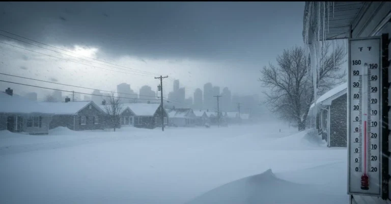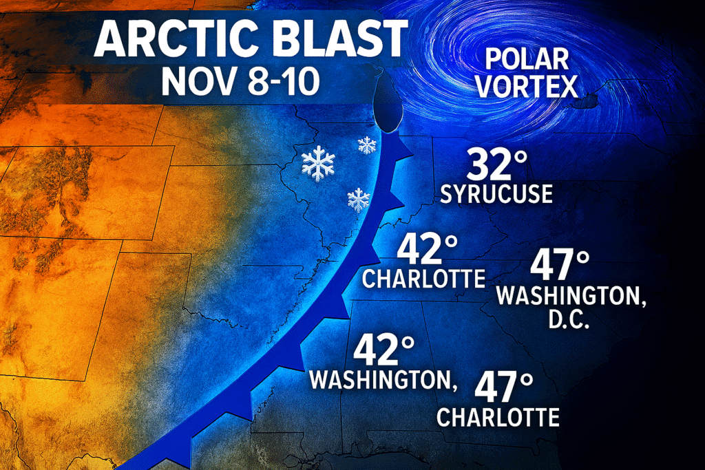
A shocking Arctic blast will send temperatures plummeting across the eastern half of the U.S. starting around Nov. 8, bringing mid-January cold to tens of millions in early November. Federal forecasters say the deep-freeze will drop readings 10-15 degrees below average.
The forecast calls for the coldest air to arrive Sunday, Nov. 9, into Monday, Nov. 10, as a strong arctic front dives south from Canada. High temperatures will struggle to reach the 30s across much of the Northeast and Great Lakes region. We’re “skipping fall and going right to winter,” said Weather Trader meteorologist Ryan Maue on X, who called the cold “shocking” and “stunning.”
Polar Vortex Drives Unseasonable Coldnov
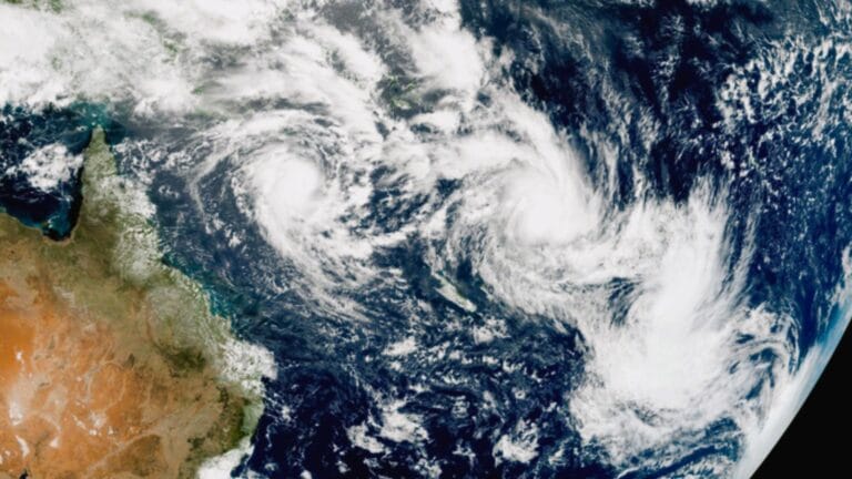
The Arctic blast comes courtesy of the polar vortex, Maue said, while the source of the cold is all the way from Greenland and the Canadian Arctic. This often misunderstood atmospheric feature is awakening again, poised to overspread large portions of the country with conditions more akin to mid-January than early November.
Ben Noll of the Washington Post said on X that “the first Arctic outbreak of the season will send temperatures tumbling from the Dakotas to Florida early next week.” Another meteorologist, Ben Noll, noted the polar vortex is an old wintertime foe that typically arrives later in the season. The dry Arctic air moving south out of Canada will drive a cold front across the central and eastern U.S. early next week, which will cause temperatures to drop to 10-15 degrees below average, according to the Weather Prediction Center.
Temperature Drop Affects Millions
Weather.com reports “The coldest air of the season will arrive Sunday (Nov. 9) into Monday (Nov. 10) of next week as a strong arctic cold front dives south into the U.S.” Highs will top out in the 30s in places like Minneapolis, Chicago and Detroit, with highs in the 40s along the I-95 corridor and as far south as Atlanta.
“It will feel more like winter by Sunday and Monday morning with lows in the teens and 20s,” according to the forecast from Weather.com. High temperatures are forecast to only reach the 30s across the Upper Midwest, Great Lakes, and northern New England, and sub-freezing lows will be possible as far south as the Central Plains and Tennessee Valley, the Weather Prediction Center said.
For many parts of the East, “there is increased potential for subfreezing overnight temperatures, likely resulting in an end to the growing season across areas that have yet to see a first freeze,” the Climate Prediction Center said. Across the Southeast, temperatures possibly falling below 40 degrees F may result in frost formation and damage to sensitive vegetation.
Cold Snap Will Be Short-Lived
Fortunately Noll said the Arctic blast will be short-lived: “It doesn’t mean that winter is arriving early. Milder air will return.” The pattern combined with the anomalously cold air also increases the potential for occasional episodes of wintry weather before conditions moderate across affected regions.
The flow pattern will bring rounds of cold air across the eastern United States through early next week. The forecast shows the cold settling in across wide areas before warmer conditions return later in the week. Time will tell how long the cold persists in different regions.
Snow Will Fly Across Northern States
Snow will fall across some northern states, especially near the Great Lakes, Noll said. Specifically, snow will be likely on Friday Nov. 7 in the high elevations of the Northwest and will be possible Saturday Nov. 8 and Sunday Nov. 9 from the Northern Plains to the Great Lakes and New England, the Weather Prediction Center said.
“Wintry weather chances will likely linger across the Great Lakes and New England through early next week underneath a deep upper level low/trough.” The flow pattern combined with the anomalously cold air also increases the potential for occasional episodes of snow across the interior Northeast and extending along the Allegheny Front, with lake-effect snow also possible downwind of Lakes Ontario and Erie, said the Climate Prediction Center.

Therefore, “a slight risk for heavy snow is posted across these areas for Nov 11-13. Snowfall amounts in the models are not all that impressive, but this would be noteworthy given that it is early in the season,” the CPC said. Lake-effect snow will develop as cold air passes over the relatively warm Great Lakes waters.
Rounds of lake-effect snow are forecast for the Great Lakes region and the Northeast. The Wintry conditions will affect multiple states as the Arctic air continues moving south through the week. Snow totals will vary depending on exact lake-effect bands and elevation in affected areas.
West Coast Sees Opposite Pattern
And at the same time, while the East shivers, much of the West will bask under unusually mild to even warm weather. Meanwhile, strong ridging developing over the Intermountain West will allow temperatures to rise to 10-15 degrees above average in that area.
According to the CPC, the entire western half of the nation will see above-average temperatures next week, with the most unusually warm weather likely over the Four Corners region. The contrast between eastern and western weather patterns will be stark, with the polar vortex affecting only the eastern portion of the country while ridging dominates the West.