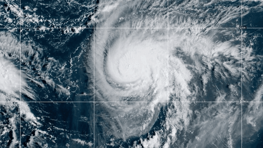
Tropical Storm Imelda is rapidly strengthening near the Bahamas this Sept. 28, threatening southeastern parts of the U.S. with potentially life-threatening flooding as the storm system heads northwest across the Atlantic. The National Hurricane Center has issued a tropical storm watch for Florida’s east coast while forecasters warn of heavy rain that could trigger flash flooding.
Currently dubbed Tropical Depression Nine, the storm was located 100 miles west-southwest of central Bahamas this morning, traveling north-northwest at 7 mph. Maximum sustained winds are near 35 mph with higher gusts, but forecasters said the tropical depression could strengthen into Tropical Storm Imelda by evening. The system could briefly reach hurricane status late Monday or Tuesday before weakening again as it approaches the southeast coast early in the week.
Storm Path Creates Uncertainty for Coastal States
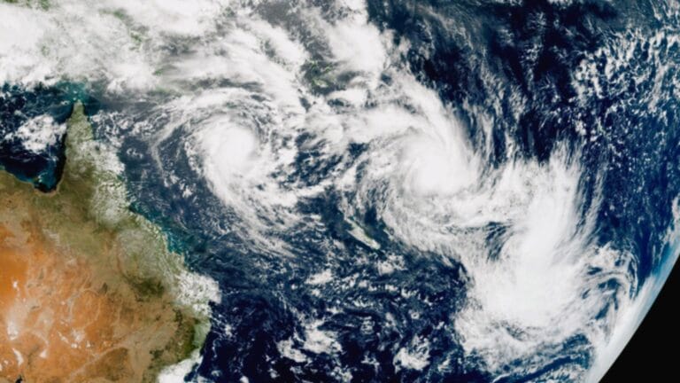
Forecasters are watching with uncertainty and concern as Imelda makes its approach toward the southeastern coast, where its exact track remains unpredictable. Most models show the storm staying offshore of the United States, though it’s still too soon to say just what track the system will take. Whether the storm will interact with strong Hurricane Humberto, currently a Category 4 storm, adds to the complexity.
The storm is heading north-northwest and its center is expected to move across the central and northwestern Bahamas during the day and night of Sept. 28 before approaching the southeast U.S. coast. Weather conditions could become dangerous as tropical storm-force winds are possible on Sept. 29, with the storm likely moving parallel to but offshore from Florida’s east coast while it strengthens.
Rainfall Predictions Point to Extreme Weather Events
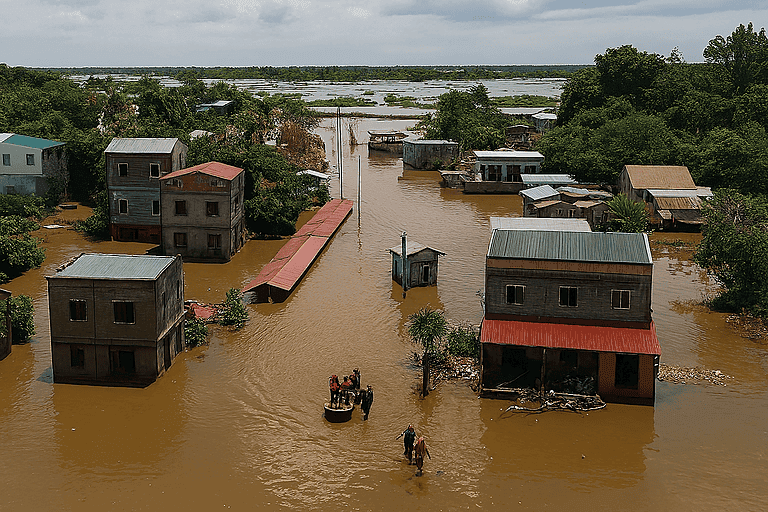
AccuWeather meteorologists warn that rainfall of this magnitude can lead to widespread life-threatening flooding, especially if the storm slows down or stalls. Between 5 and 10 inches of rain could fall in coastal southeastern parts of North and South Carolina through the first couple days of October, according to the Weather Prediction Center.
Higher totals could fall locally and could lead to “scattered pockets of flash flooding.” From far eastern Georgia to central Virginia, 2 to 4 inches could fall, while the Carolina coasts could see upward of 8 to 16 inches. Any amount lingering in one area could spell extreme rainfall and potential flooding as Imelda reaches near southeastern states including the Carolinas and Georgia and weakens from Sept. 30.
Hurricane Science Behind Storm Formation
Hurricanes are born in the tropics, above warm water. Clusters of thunderstorms can develop over the ocean when water temperatures exceed 80 degrees Fahrenheit. If conditions are right, the clusters swirl into a storm known as a tropical wave or tropical depression. A tropical depression becomes a named tropical storm once its sustained wind speeds reach 39 miles per hour. When its winds reach 74 mph, the storm officially becomes a hurricane.
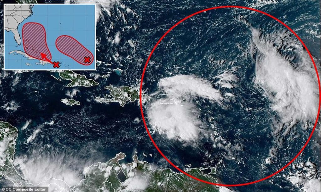
Imelda’s movements later in the week are harder to peg, forecasters have said. The storm could interact with Hurricane Humberto in a Fujiwhara effect dance. Or, they could both go off in different directions. This forecast shows the most likely path of the center of the storm. It does not illustrate the full width of the storm or its impacts, and the center of the storm is likely to travel outside the cone up to 33 percent of the time.
Preparations Critical Before Storm Arrival
Prepare now for hurricanes. Delaying potentially lifesaving preparations could mean waiting until it’s too late. “Get your disaster supplies while the shelves are still stocked, and get that insurance checkup early, as flood insurance requires a 30-day waiting period,” the National Oceanic and Atmospheric Administration recommends. Develop an evacuation plan. If you are at risk from hurricanes, you need an evacuation plan. Now is the time to begin planning where you would go and how you would get there.
Assemble disaster supplies. Whether you’re evacuating or sheltering in place, you’re going to need supplies not just to get through the storm but for a possibly lengthy aftermath, NOAA said. Get an insurance checkup and document your possessions. Contact your insurance company or agent now and ask for an insurance checkup to make sure you have enough insurance to repair or even replace your home and belongings. Remember, home and renters insurance don’t cover flooding, so you’ll need a separate policy for those. Flood insurance is available through your company, agent or the National Flood Insurance Program. Act now, because flood insurance requires a 30-day waiting period.
Complete Hurricane Safety Planning
Create a family communication plan. NOAA says you should take the time now to write down a hurricane plan and share it with your family. Determine family meeting places and make sure to include an out-of-town location in case of evacuation. Strengthen your home. Now is the time to improve your home’s ability to withstand hurricanes. Trim trees and install storm shutters, accordion shutters and impact glass; seal outside wall openings.
The uncertainty creates concern for residents as the system is anticipated to bring dangerous surf conditions to several southeastern states that could cause some instances of flooding. Tropical storm conditions with dangerous surf and heavy rain trigger flash flooding potential across multiple coastal areas where millions live and work.