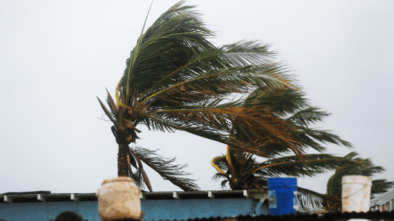
Australia’s cyclone season has officially begun, and it’s not looking good. Meteorologists are warning that unusually warm ocean temperatures are creating fuel for what could be the fiercest tropical storms we’ve seen in almost two decades. The 2025-26 season started November 1, and already the signs are there – sea surface temperatures in northern Australia are sitting well above normal. That’s bad news for the millions of Australians living along coastlines who are now facing a serious threat.
Here’s the thing about cyclones – they feed off warm water. And right now, there’s plenty of it. Sea temperatures in northern regions have climbed past 27C, with some hotspots hitting up to 31C recorded across Queensland’s Gulf waters and the Northern Territory’s Top End. Weatherzone meteorologist Ben Domensino said these readings are sitting one to three degrees above what we’d normally see, and they rank in the top 10 per cent of historical records for this time of year.
Mr Domensino broke it down pretty simply: all cyclones need sea surface temperatures at or above 26.5 degrees to even form. Once you’re over this threshold, things can get nasty fast. The rate at which tropical cyclones can intensify basically increases with higher ocean temperatures. So when you’ve got abnormally warm waters spreading across the region, you’re essentially providing abundant fuel for cyclone development all summer long. It’s like leaving petrol cans lying around during bushfire season – eventually something’s going to ignite.
Look, the ocean is basically a giant battery for weather systems. When water temperatures get hot enough, they’re pumping massive amounts of energy into the air above. Right now, the heat in Australian waters isn’t just at the surface – it goes deep. Northern coastal areas are copping what scientists call marine heatwave conditions. These aren’t your average warm days; we’re talking temperatures staying elevated week after week.
And here’s where it gets scary. A cyclone tracking over such warm sea surface areas can jump from a category one to a category three or higher in just hours. Not days – hours. Some computer models are showing that if a tropical low forms right now in these conditions, it could reach severe status faster than anything we’ve seen in recent years. Plus, there’s more moisture in the atmosphere than usual, which is extra energy for storm development. It’s all lining up in the worst possible way.
Weather Experts say the proportion of intense systems this year is expected to be unusually high. Translation: more big, bad storms. Tropical systems that do form are expected to have a higher-than-normal likelihood of strengthening into severe category three or worse. Normally, during a typical season between November and April, you’d see about nine cyclones form in the Australian region. About half of those might hit category three strength or higher.
But this year? Meteorologists reckon the volatile and dangerous conditions could lead to way more intense storms developing over the coming months. Those ridiculously hot water temperatures mean there’s just so much more energy available for tropical systems to tap into. If you’re anywhere from Cairns up to Broome, or down the eastern coast to northern NSW, you need to be paying attention to weather updates. Not next month – now.
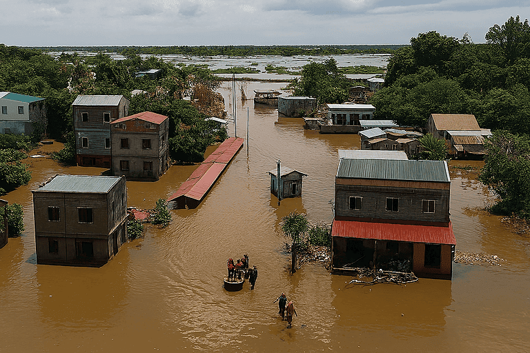
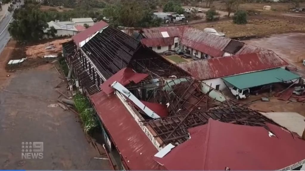
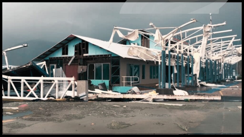
Last season saw 12 cyclones in Australian waters – the highest number in almost two decades. Among them was Cyclone Alfred, and if you were in its path, you won’t forget it. Alfred slammed into Queensland and NSW in March, leaving behind almost $2bn in damage. It’s now the fourth costliest cyclone in the nation’s history. Houses smashed, businesses wrecked, whole communities torn apart from Far North Queensland right down the coast.
The insurance claims from Alfred are still being sorted out. Some people are still rebuilding. And that’s exactly what weather experts are worried about happening again this summer. The early signs suggest this season could throw up similar disasters, especially with these worrying ocean readings that keep climbing. With seas already surging above normal levels right at the start of November, everything’s primed for storms to develop and intensify quickly. We’re not even into the peak months yet.
The millions of people living along tropical coastlines should be getting their plans sorted now. Some regions are already seeing temperatures perfect for storm formation, and we’re still well before the traditional danger period. If you’re in coastal towns from Darwin across to Townsville, pull out those emergency plans. Check them. Update them. Don’t wait until there’s a red blob on the radar heading your way.
The mix of warm sea surface conditions plus other atmospheric stuff is creating ideal circumstances for severe tropical storms. Weatherzone data shows northern Australian waters are running seriously hot, especially near the Gulf and Top End. These numbers are way off what we’d call normal, and they’re suggesting the 2025-26 cyclone season could smash historical records from recent decades.
There’s another factor too – wind shear, which usually helps break up forming storms, is forecast to stay weak through December and January. That’s basically removing one of nature’s safety switches. More storms can form, and they can get stronger faster.
With the season underway, you can’t just relax until April. The likelihood of dangerous weather stays high right through November, December, January, February, March, and into April. And don’t think you’re safe just because you’re not on the beach – inland flooding from cyclones often causes as much damage as the wind when these things move onshore and then stall.
Mr Domensino and his colleagues keep watching the sea conditions constantly, tracking how the abnormally warm ocean temperatures change week by week. They’ve got satellites, ocean buoys, computer models – all feeding data about where and when the next system might pop up. The proportion of storms hitting severe levels looks set to beat typical patterns by quite a bit.
Bottom line: knowing which areas face the greater risk and having your plans ready could literally save your life as this potentially fiercest season in two decades plays out across Australia’s north and east. Get your emergency kit together. Know where you’d evacuate to. Keep your phone charged when warnings come through. The Bureau will keep updating forecasts, but don’t be that person who waits until a cyclone’s at your doorstep to start panicking.